Also called: seismic refraction, electrical resistivity, MASW, marine sub-bottom profiling
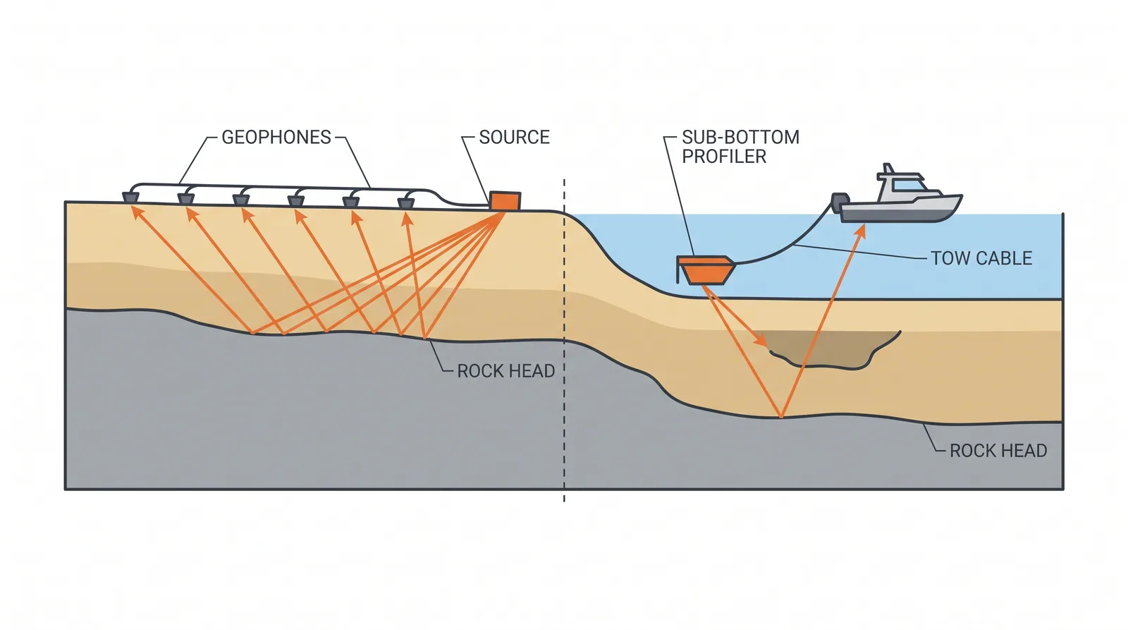
How it is done
- Define the targets (rock head, buried channels, cavities, soft pockets, obstructions, shear-wave velocity for site class) and choose methods by the physical contrast each target offers.
- Run a trial line over an existing borehole to confirm the method can see the target before committing to the full survey.
- On land, lay seismic refraction, MASW or resistivity lines along the alignment and across each support, with the spread length set by the required depth.
- Over water, survey with multibeam bathymetry, side-scan sonar, a sub-bottom profiler and a magnetometer on a grid with cross lines, logging RTK position and tide.
- Process and invert the data, stating resolution and known artefacts; tie each section to boreholes at line intersections.
- Feed the results into the ground model: place the next boreholes on anomalies and use the sections to interpolate between holes.
- For seismic design, measure the shear-wave velocity profile to at least 30 m with MASW, downhole, crosshole or seismic CPT tests.
Key numbers
- Depth reachedroughly one fifth to one third of the spread length for refraction and resistivity lines.
- Site class by Vs30 (Eurocode 8)A above 800 m/s, B 360–800 m/s, C 180–360 m/s, D below 180 m/s.
- Sub-bottom profilerschirp systems resolve decimetres over the top 5–30 m of soft sediment; boomers and sparkers reach 50 m or more at metre resolution.
- Output1–3 km of seismic or resistivity line per day on land; tens of line-km per day for marine surveys.
Where it fits
- Long alignments, karst, buried channels, marine sites before the drilling campaign.
- Sites where access for rigs is limited.
Where it does not
- Using geophysics as the only evidence for a foundation level.
Choosing it
- Use geophysics before drilling on long alignments, over water and in karst: it puts boreholes where the ground changes.
- Prefer more boreholes on short crossings with only a few closely spaced supports, where geophysics adds little.
- Choose MASW or seismic CPT for stiffness and site class, resistivity or microgravity for cavities, and sub-bottom profiling for marine sediment thickness and channels.
- Never fix founding levels on geophysics alone: inversions are not unique and must be checked by drilling.
Plant, pace and money
Risks and controls
What goes wrong
- Ambiguous inversions; a thin hard layer over soft can hide the soft.
Quality assurance
Calibration boreholes at line intersections; interpretation reported with confidence levels.
Origins
Seismic refraction moved from oil prospecting (Mintrop's work around 1919–1920) to dam and foundation sites in the 1920s and 1930s; resistivity sounding dates from Wenner (1915) and the Schlumberger brothers; MASW was introduced by the Kansas Geological Survey in 1999.
Examples
Sub-bottom profiling is routine before marine bridge investigations in the Gulf and Southeast Asia.
Case studies
Related methods
Further reading
ASTM D5777 (seismic refraction) · ASTM D6431 (resistivity) · ASTM D6429 (guide for selecting surface geophysical methods) · Geological Society Engineering Group Working Party, Geophysics in Engineering Investigations (CIRIA C562)